
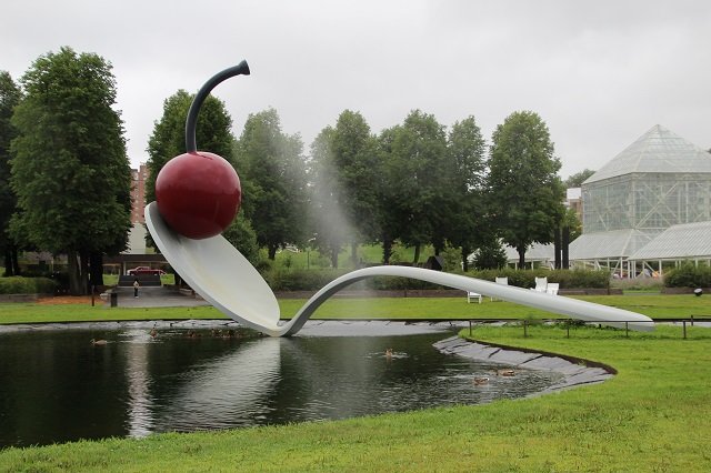
The Minneapolis Sculpture Garden was one thing on our Mid-West Adventures through IA, MN, and NE trip. It is one of the largest urban sculpture gardens in the […]
Minnesota / Museum / Road Trip / United States
Posted on:
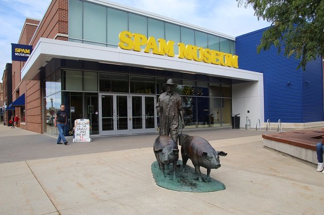
SPAM Museum by Hormel – Austin, Minnesota
Welcome to Austin, MN and the home of the SPAM Museum. As stated on my Midwest Adventures blog post, we had been in Des Moines, IA for their […]
Art / Ballparks / Capitol Building / Iowa / Minnesota / Misc / Museum / Nebraska / Road Trip / Tour / United States
Posted on:
Mid-West Adventure through IA, MN and NE – August 2023
Last month Gene got some unexpected time off (expiring vacation days) and we decided to do a Mid-West adventure through IA, MN, and NE. The first stop on […]
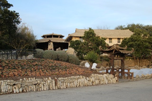
Garden / Road Trip / Texas / United States
Posted on:
Japanese Tea Garden – San Antonio, Texas
Last year, Gene and I spent Christmas and New Years in San Antonio, Texas. One day after spending a few hours at the Alamo and River Walk, we […]
Colorado / Road Trip / Tour / United States
Posted on:
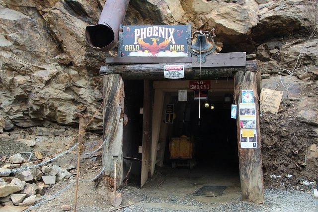
Phoenix Gold Mine Tour – Idaho Springs, Colorado
A couple of years ago we only had a few days for our anniversary so we spent a long weekend in Idaho Springs here in CO. It’s only […]
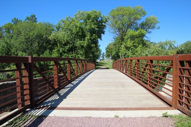
Arkansas / Art / Bridges / Parks / Road Trip / United States
Posted on:
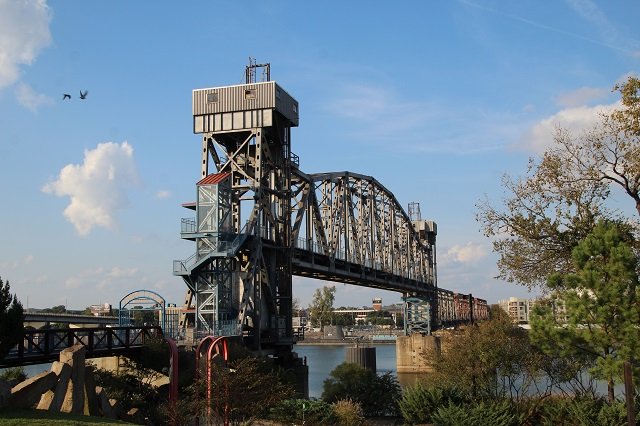
Junction Bridge and Riverfront Park – Little Rock, Arkansas
While in Little Rock, Arkansas we did a lot of exploring, and enjoyed checking out the Arkansas River. One of the cool things we saw was the Junction […]
History / Montana / Monument / National Parks / Road Trip / United States
Posted on:
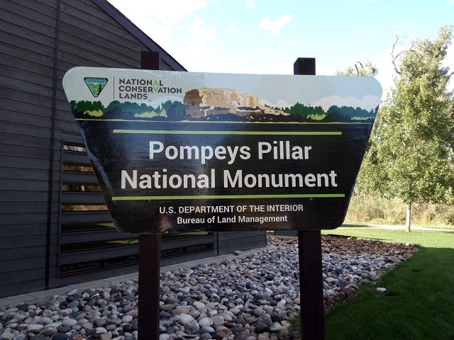
Pompeys Pillar National Monument – Pompeys Pillar, Montana
Standing 150 feet above the Yellowstone River in Southern Montana and consisting of sandstone from the late Cretaceous Hell Creek Formation, 75 – 66 million years ago, is […]
History / Museum / Road Trip / Tennessee / United States
Posted on:
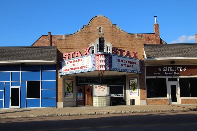
Stax Museum of American Soul Music – Memphis, Tennessee
While in Memphis in October of 2020, we did a lot of museums related to music such as the Rock n Soul Museum, Sun Studio, as well as […]
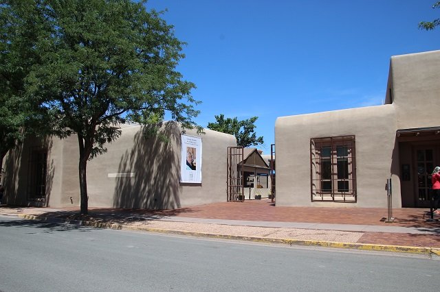
Art / Museum / New Mexico / Road Trip / Tour / United States
Posted on:
Georgia O’Keeffe Museum – Santa Fe, New Mexico
Located in Santa Fe, New Mexico, the Georgia O’Keeffe Museum is something I had wanted to visit and explore for quite a while. I was very happy […]
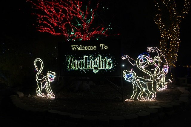
Arizona / Holidays / Road Trip / United States / Zoo
Posted on:
Phoenix Zoo Lights – An Annual Tradition in Phoenix, Arizona
Last year we were in Phoenix on Christmas and Gene and I went to the Phoenix Zoo Zoo Lights with my best friend’s sister and brother’s families. It […]