Pompeys Pillar National Monument – Pompeys Pillar, Montana

Pompeys Pillar National Monument - Sign

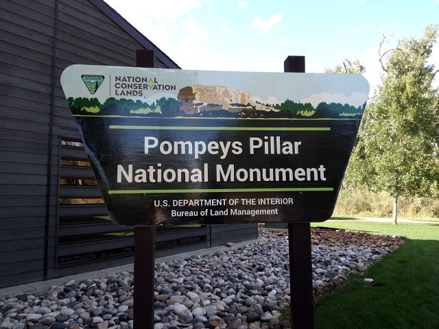
Standing 150 feet above the Yellowstone River in Southern Montana and consisting of sandstone from the late Cretaceous Hell Creek Formation, 75 – 66 million years ago, is Pompeys Pillar National Monument. While we were staying in the area to see family, and being related to John Colter of the Lewis and Clark expedition, we made sure to check it out one evening. Although perhaps best known for the inscription left behind by William Clark of the expedition, this site boasts the markings of thousands of years of human occupation. I will share more about the monument in a minute, but first want to share a little about the interpretive center.

Pompeys Pillar National Monument - Tepee

The Pompeys Pillar Interpretive Center opened in 2006. Exhibits in the 5,700-square foot center relate the journey of Captain William Clark and his detachment, including Sacagawea and her son Pomp, down the Yellowstone River Valley in 1806. The center also addresses native culture, flora and fauna, the Lewis and Clark Expedition, and the historical legacy of Pompeys Pillar through the changes of the 1800s. A number of J.K. Ralston paintings and sketches are on permanent display.

Pompeys Pillar National Monument - Statue of Clark

We enjoyed walking around and checking out some of their exhibits. Of course, you can’t miss the huge tepee right out front. As you make your way inside the center you will find a bronze sculpture of William Clark between a US and Montana flag. I enjoyed reading about Sacagawea and her son on one of the displays. Another cool thing to see was a canoe on the grounds.

Pompeys Pillar National Monument - Canoe

For a little bit of history about the Lewis and Clark expedition and Pompeys Pillar National Monument from the Friends of Pompeys PIllar:  On July 3, 1806, after crossing the Continental Divide, the Corps split into separate groups so Lewis could explore the Marias River. Lewis and Clark stayed separated until they reached the confluence of the Yellowstone and Missouri Rivers. During their separation, Captain William Clark visited Pompeys Pillar on July 25, 1806.

Pompeys Pillar National Monument - View 1

On July 25, in Clark’s group, the nine floaters noticed a huge sandstone rock “200 feet high and 400 paces in circumference” not far from the river.  Clark climbed it and saw “Emence herds of Buffalows, Elk and wolves.” Indian pictographs were on the rock, and to them he added his name and the date: Wm. Clark, July 25, 1806.  He named the rock Pompy’s Tower (now called Pompeys Pillar) after Sacagawea’s baby, whom she carried on a cradleboard strapped to her back for the 14 months that she accompanied and aided the expedition.

Pompeys Pillar National Monument - Sacagwea

In Clark’s own words, “…at 4 P.M. arrived at a remarkable rock Situated in an extensive bottom on the Start.  Side of the river & 250 paces from it.  This rock I ascended and from it’s top had a most extensive view in every direction.  This rock which I shall Call Pompy’s Tower is 200 feet high and 400 paces in secumphrance….”

Pompeys Pillar National Monument - Signature

He also described the view from atop “Pompy’s Tower”: From the top of this Tower I could discover two low Mountains & the Rocky Mts. Covered with Snow S W. One of them appeared to be extencive and bore S. 15° E. about 40 miles. The other I take to be what the Indians Call the Little wolf Mtn. I can only see the Southern extremity of it which bears N 55° about 35 Miles. The plains to the South rise from the distance of about 6 miles the width of the bottom gradually to the mountains in that derection. A large Creek with an extencive Vally the direction of which is S. 25° E. meanders boutifully through this plain.

Pompeys Pillar National Monument - Center

Today, a boardwalk leads to Capt. Clark’s signature and to the top of the Pillar, which is the last physical evidence of the Lewis and Clark Expedition. You also get a great view of the Interpitve center from the top.  As I said earlier, trails lead visitors past a replica of Captain Clark’s canoes and to a view of the 670-mile-long Yellowstone River.

Pompeys Pillar National Monument - Us

We made our way up a whole bunch of steps and I couldn’t help but think what it would have been like for Clark’s team without the stairs, and with all their gear. Wow, was all I could think when we did get to the top. It was beautiful, and you could see so for miles it seemed. Also impressive was being able to see where Clark inscribed his name and date. We took a few pictures, but mostly just sat and enjoyed the views until it started getting dark.  We headed back down with a little more knowledge about the area, and great memories.

Pompeys Pillar National Monument - Signature 2

Have you been to see Pompeys Pillar National Monument? If so, let me know what you thought about your visit. If you haven’t been, I would highly suggest a visit while in the Billings area. Happy travels.

Pompeys Pillar National Monument Visitor Information

Address:

3039 US Highway 312 Pompeys Pillar, MT 59064

Phone:

406-896-5013

Hours & Fees:

When the Monument is open (see below for season and hours), a $7 standard fee is charged for each vehicle. There is no separate fee for the interpretive center.  All valid federal recreation passes are honored at the site.

Private Vehicle Standard Fee

Rates are based on number of passengers.

6 passengers and under–$7

7-25 passengers–$12

26+ passengers–$20

2023 Season/Hours

May 1 through September 30

Main Gate: 8:30 a.m. to 4:30 p.m.

Interpretive Center Hours:

  • May-September: 9 a.m. to 4 p.m. daily

Commercial/Group Vehicle Fees

Commercial group rates are based on vehicle capacity.

Vehicles capable of seating 6 passengers and under–$25

Vehicles capable of seating 7-25 passengers–$40

Vehicles capable of seating 26+ passengers–$100

Directions:

The area is easily accessible from Interstate 94, using exit 23, or from State Highway 312. The monument is 25 miles east of Billings, Montana

Accessibility

The interpretive center, restrooms, parking lot and day use area are fully accessible.

Pets

Pets must be on a leash at all times.

Treasure Falls and Wolf Creek Pass in Colorado – Breathtaking Views

Treasure Falls and Wolf Creek Pass - 1After leaving the wonderful Pagosa Springs area on our anniversary in May 2017, we headed to Canon City to explore the Royal Gorge Bridge and Park. We marveled at the amazing Treasure Falls just a few minutes out of Pagosa. Then we were able to enjoy some breathtaking views at Wolf Creek Pass.  Both were amazing and we were glad we were able to see them on our way out of the Pagosa Springs area. Continue reading “Treasure Falls and Wolf Creek Pass in Colorado – Breathtaking Views”

Colorado Road Trips – Some of our Favorites Around the State

We have now lived in Colorado for many years and really enjoy the beauty and variety in this beautiful state. While we have explored quite a few places since we have been here, we haven’t visited as many as we would have liked. We know we aren’t going to be in this colorful state forever and made a plan to see more of it. Thus we have done a few road trips and wanted to share which Colorado road trips we have enjoyed the most.  Today I want to share some of the trips we’ve taken along the I-70 from Idaho Springs, to Loveland Pass, and then out to Dillion Reservoir. While we didn’t necessarily do these all in one day, we really enjoyed them and I decided to share them all as one post. We also did the Peak to Peak Highway one time and I will share that separately. But today I will start with Idaho Springs and work our way westward.

Continue reading “Colorado Road Trips – Some of our Favorites Around the State”